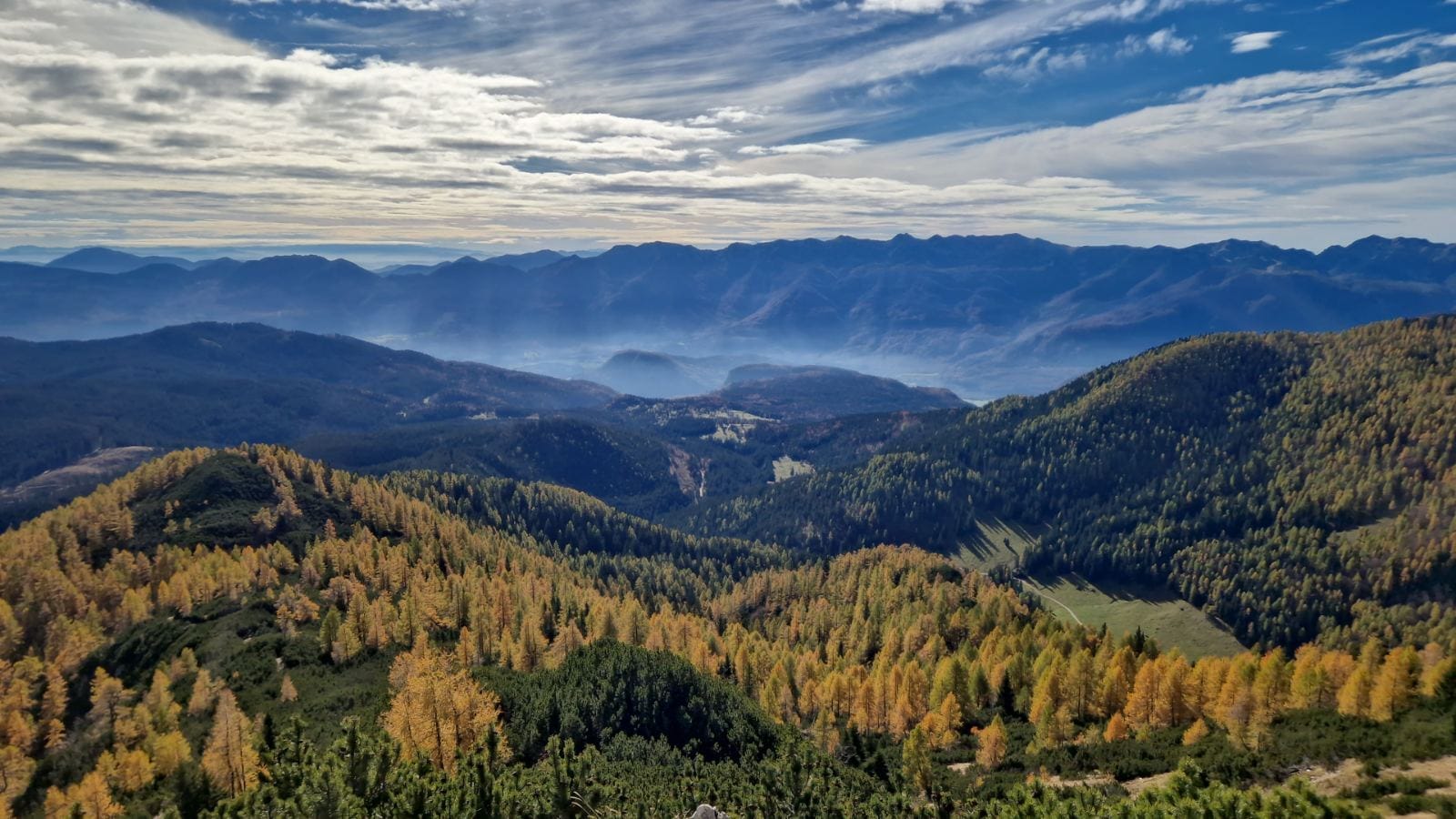
Viševnik (2,050 m) is routinely named the most-visited peak above 2,000 m in Slovenia — not because it’s spectacular in a way other summits aren’t, but because the standard route from Rudno polje on the Pokljuka plateau is short (about 2 hours up), well-marked, and technically easy, with no scrambling, cables or via-ferrata gear required. It’s the two-thousander most hikers do first, before taking on something like Triglav itself.
Viševnik rises on the ridge separating the Krma valley from the Pokljuka plateau, inside Triglav National Park’s Julian Alps. From the summit, Triglav fills the skyline close enough to pick out the Kredarica and Planika huts on its flanks — part of why this is such a popular warm-up hike before climbing Triglav itself, or a satisfying substitute for hikers who’d rather not commit to the two-day trip.
The easy reputation only applies to the direct route, though. Two marked loop variants — via Kačji rob, or via Jezerce and the Srenjski preval saddle — step up to “partly demanding” terrain with loose scree and some exposure, opening onto a wider circuit toward Blejska koča na Lipanci. For the rest of what counts as a mountain day in this part of Slovenia, see our Slovenian Mountains guide.
At a Glance
- Elevation2,050 m
- Mountain rangeJulian Alps, Triglav National Park — on the ridge between the Krma valley and the Pokljuka plateau
- Mountain hutBlejska koča na Lipanci (1,630 m), about 2 h from the summit — no hut directly on Viševnik itself
- Overall difficultyEasy to partly demanding (lahka–delno zahtevna pot), depending on route
What to Expect on the Trail
The standard route starts at Rudno polje (1,347 m) on a gravel forest road that runs between the Pokljuka Barracks and Hotel Center Pokljuka’s biathlon stadium. After about 10 minutes you reach the edge of the Pokljuka ski area, where the marked trail crosses a grassy ski slope — grazed by cattle in summer — before narrowing into a steeper gully path that climbs alongside the old chairlift line.
From there the trail reaches Plesišče saddle in a little under an hour, then turns through a belt of dwarf pine (ruševje) and larch onto the open, grassy slopes just below the summit. The final stretch alternates between easier ground and short steeper pulls before reaching the top, where a summit marker (žig) sits at the highest point of the ridge — the standard reward for roughly 700 m of elevation gain over a 6.5 km round trip.
Hikers continuing on the loop variants face different terrain: the path toward Srenjski preval crosses open, sunny slopes with loose scree just above the saddle, and the optional side-trip to Mali Draški vrh is genuinely loose rock that several guides recommend a helmet for. None of this requires climbing gear, but it’s a different proposition from the direct route in wet, icy, or early-season snow conditions.
How Difficulty Is Graded
Slovenia grades marked mountain trails into three official PZS categories, shown on maps and signposts as lahka pot (easy), zahtevna pot (demanding, often with secured or exposed sections) and zelo zahtevna pot (very demanding, technical alpine terrain). Trail databases like hribi.net also use an informal fourth label, delno zahtevna (“partly demanding”), for a route that’s mostly easy with one harder stretch mixed in — which is exactly how Viševnik’s two loop variants are classified, while the direct Rudno polje route stays a straightforward easy trail the whole way.
- Easy — lahka markirana pot
The direct route from Rudno polje — about 2 hours up, well-graded the whole way, no exposure. This is the route behind Viševnik’s reputation as Slovenia’s easiest two-thousander.
- Partly demanding — delno zahtevna markirana pot
The loop variants via Kačji rob (2 h 30 min) and via Jezerce and Srenjski preval (2 h 40 min) — mostly easy walking with a looser, more exposed stretch near the saddle.
- Demanding — zahtevna označena pot
Not part of any standard marked route to the summit itself — the closest equivalent is the unmarked, loose-rock side-trip to Mali Draški vrh, where a helmet is genuinely worth carrying.
- Very demanding — zelo zahtevna označena pot
Technical alpine terrain — not relevant to Viševnik; for that, our climbing Triglav guide is the better comparison.
Choose Your Route
Hribi.net’s route tables list 21 variants to Viševnik from villages as far out as Srednja vas and Uskovnica, but almost everyone starts at Rudno polje. The four options below cover the realistic choices from there — hiking times are one-way to the summit unless noted.
Rudno polje, direct
≈2 h up, ≈1 h 30 min down
Easy marked trail (lahka markirana pot)
Forest road past the ski area, a steeper gully beside the old chairlift, then Plesišče saddle and a dwarf-pine belt to the grassy summit slopes.
Rudno polje car park (1,347 m)
Rudno polje, via Jezerce and Srenjski preval
≈2 h 40 min up; the full circuit back via Konjščica takes roughly 1 h 30 min more
Partly demanding marked trail (delno zahtevna pot)
Crosses the Jezerce basin and climbs to Srenjski preval saddle, where loose scree just below the ridge calls for careful footing. An optional, unmarked detour to Mali Draški vrh from the saddle is loose rock — bring a helmet if you take it.
Rudno polje car park, returning via Konjščica pasture
Rudno polje, via Kačji rob
≈2 h 30 min
Partly demanding marked trail (delno zahtevna pot)
A steeper, less-used alternative to the direct route — a good pick if you want a different way down after going up via Route 1.
Rudno polje car park
Viševnik to Blejska koča na Lipanci
≈2 h from the Viševnik summit to the hut; ≈1 h 15 min on from the hut back to Rudno polje
Easy to moderate marked trail along the ridge
The natural way to turn a summit-and-back trip into a longer day — descends the ridge toward Lipanca instead of retracing Route 1.
Viševnik summit, ending at Blejska koča na Lipanci or back at Rudno polje
Getting to the Trailhead
Rudno polje sits on the Pokljuka plateau, reached by paved road from Mrzli studenec — about 30 minutes’ drive from Lake Bled, 35 minutes from Ribčev Laz or Stara Fužina on Lake Bohinj, and roughly an hour from Ljubljana. See our guide to driving in Slovenia if you’re renting a car for the trip.
There’s no public transport directly to the trailhead, so you’re looking at your own car or a taxi. Rudno polje has more than one car park — sources describe a free lot near the old army barracks alongside a separate, paid lot in front of Hotel Center Pokljuka — so check current signage and pricing when you arrive rather than assuming either option.
What to Bring
- Sturdy boots and trekking poles — useful on the gully section and genuinely helpful on the loose scree near Srenjski preval.
- Enough water for the climb — there’s no reliable water source along the route.
- A windproof layer — the open, grassy slopes near the summit catch wind even on calm days below.
- A headlamp if you’re starting before dawn — Viševnik is a popular sunrise hike, and summer afternoons bring thunderstorm risk that rewards an early start anyway.
- A map (PZS Julian Alps East, 1:50,000) or an offline GPX track — useful wherever the loop variants branch off from the direct route.
- A helmet — only if you’re adding the Mali Draški vrh side-trip, where loose rock is a real hazard.
When to Go
Late spring brings the best wildflowers — globe flowers and spring gentians along the lower slopes — but snow can linger in the basin below the summit into mid-June, so an early-season trip is worth checking on beforehand (Hotel Center Pokljuka, at the trailhead, or a Pokljuka webcam are the usual ways locals check). Viševnik is popular year-round, including as a winter and sunrise hike, but the upper slopes near Srenjski preval carry a real avalanche and slip risk early in the season, and summer afternoons regularly bring thunderstorms — most regular hikers start early for exactly that reason.
The hazards here are seasonal and route-specific, not constant. The direct route from Rudno polje is genuinely easy in good summer conditions; the risk concentrates on the loose scree above Srenjski preval, on the unmarked Mali Draški vrh side-trip, and on any part of the upper mountain carrying early-season snow or ice. Afternoon thunderstorms are common in summer on this exposed, open terrain, which is why most hikers start early.
Viševnik sits inside Triglav National Park, so park rules on camping, fires, and staying on marked trails apply here too. In an emergency, call 112 for Slovenia’s mountain rescue service, Gorska reševalna zveza Slovenije, and be ready to name the last marked point or saddle you passed.
The Hut
1,630 m — on the Lipanci pasture, below Lipanski vrh
Open year-round, per the hut’s own listing — confirm current hours before an off-peak visit
Not published online — call ahead if you’re planning to stay overnight
A menu built around stews, with warm tea in winter and cold drinks in summer — a good stop before the descent to Rudno polje
051 621 021 · Zgornje Gorje 98, 4247 Zgornje Gorje
Day Hike or Overnight?
Almost everyone climbs Viševnik as a straightforward day trip from Rudno polje — the direct route is comfortably done there and back in 3 to 3.5 hours, leaving plenty of the day free.
The obvious choice unless you specifically want to extend the trip toward Lipanca.
Descending the ridge to Blejska koča instead of retracing your steps turns Viševnik into a longer loop, with a hut stop for food on the way back down toward Rudno polje or on to Bled.
A reasonable way to see more of the ridge without any extra technical difficulty — just extra time and a longer return.
More Ways to Experience Slovenia’s Via Ferratas
Partner link — booking through this widget supports Tips in Slovenia at no extra cost to you.
Frequently Asked Questions
How high is Viševnik?
2,050 m. It sits on the ridge between the Krma valley and the Pokljuka plateau, inside Triglav National Park.
Is Viševnik hard to climb?
Not by the standard route — the direct path from Rudno polje is an easy marked trail, about 2 hours up, with no climbing or exposure. That’s exactly why it’s considered the most-visited two-thousander in Slovenia. The loop variants via Kačji rob or Srenjski preval are a step up, with loose scree and some exposure.
How long does it take to climb Viševnik?
About 2 hours up and 1.5 hours down by the direct route from Rudno polje — roughly 3 to 3.5 hours round trip. The loop variants and the extension to Blejska koča na Lipanci take longer.
Do I need any special gear or a guide?
No technical gear or guide is needed for the standard route — sturdy boots and poles are enough. A helmet is only worth carrying if you add the unmarked side-trip to Mali Draški vrh, where the rock is loose.
Can I combine Viševnik with climbing Triglav?
Not directly on a single day’s route, but the ridge toward Blejska koča na Lipanci opens onto longer multi-day options in the area. Most hikers treat Viševnik as a separate, easier warm-up rather than a direct approach to Triglav — see our climbing Triglav guide for that route specifically.
More to read
Fresh from Slovenia Travel Tips
Thermal Spas in Slovenia: The Best Terme for a Winter Visit
Quick answer: Slovenia’s thermal spas (terme) stay open all winter, but what’s actually usable varies a lot by…

Slovenia Travel in December: Weather, Crowds, Hiking and What to Expect
December is when Slovenia goes fully festive and genuinely cold — lift-served skiing begins at the lower resorts,…
Christmas Markets in Slovenia Beyond Ljubljana: Ptuj, Kranj, Bled, Maribor and Celje
Quick answer: Ljubljana isn’t the only Slovenian city with a festive December program. Ptuj, Kranj, Bled, Maribor and…
More from Slovenian Mountains: for the full alpine version of this trip, see our guide to climbing Triglav, or the gentler valley walk in Triglav Lakes Valley. For something lower and easier still, our Ratitovec guide covers a genuine first-mountain hike. Otherwise, head back to Slovenian Mountains or Destinations for the full regional overview.

Related guides
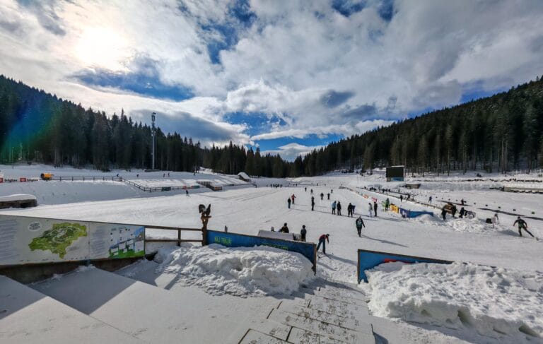 Pokljuka: Hiking, Biathlon and Cross-Country Skiing on Slovenia’s High PlateauPokljuka is a forested karst plateau in the Julian Alps, about 15 km west of Bled and part…
 Skiing in Slovenia: Resorts, Piste Lengths and 2026/27 Opening DatesSlovenia’s ski season normally runs from late November to late March, spread across eleven resorts from the high…
 Via Ferratas in Slovenia: Routes, Grading and What to Know Before You GoVia ferratas are protected climbing routes — fixed cables, metal rungs and pegs bolted into the rock —…