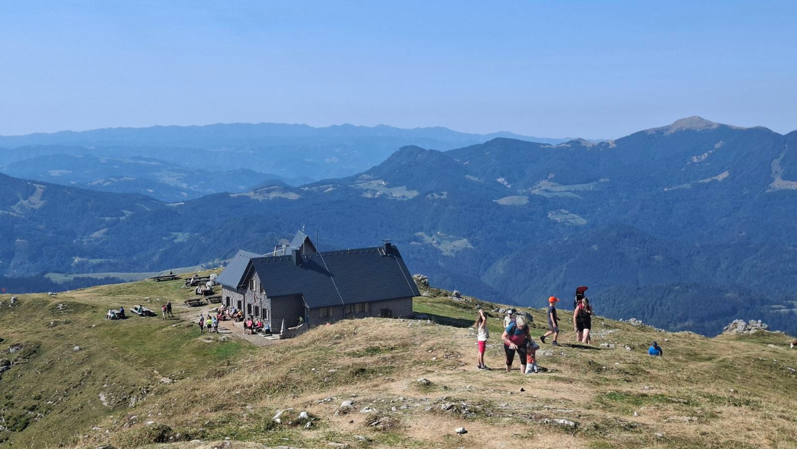
Ratitovec is a long, grassy ridge in the Škofja Loka Hills (Škofjeloško hribovje) with two summits close together — Gladki vrh (1,667 m), often called simply “Ratitovec,” and Altemaver (1,678 m), the ridge’s actual high point, an easy 20–30 minute walk further along. Unlike Triglav, this is a genuine day-hike mountain: several routes are gentle enough for a first proper Slovenian hike, and the payoff is one of the best panoramic views of the Triglav massif anywhere outside the Julian Alps themselves.
Ratitovec sits a little apart from our other Slovenian Mountains guides — it’s lower, easier, and open year-round, which makes it a good pick if climbing Triglav itself feels like too much of a commitment, or if you just want a proper mountain day without the two-day logistics.
Sources genuinely disagree on exactly where to draw the line around Ratitovec’s mountain range: some call the Škofja Loka Hills the easternmost extension of the Julian Alps, others treat them as a separate pre-Alpine range (predalpsko hribovje) south of the real high peaks. Either way, the practical point for a hiker is the same — this is lower, gentler terrain than the Julian Alps proper, with views straight across to them.
At a Glance
- Elevation1,667–1,678 m (Gladki vrh to Altemaver, the ridge’s high point)
- Mountain rangeŠkofjeloško hribovje (Škofja Loka Hills) — sometimes classed as the easternmost Julian Alps, sometimes as separate pre-Alpine hills
- Mountain hutKrekova koča na Ratitovcu (1,642 m)
- Overall difficultyEasy to demanding (lahka–zahtevna pot), depending on route
What to Expect on the Trail
Most approaches start in the villages of the Selška dolina — Prtovč or Torka — and climb through forest before breaking out onto the open, grassy ridge that gives Ratitovec its character. Compared to the high peaks further north, the going underfoot is friendlier: dirt and grass rather than scree and bare rock for most of the way, with the terrain only turning genuinely rocky in one specific stretch near the Poden saddle.
That stretch is worth knowing about in advance. The routes that cross Poden saddle from the south involve a short, exposed, rocky section that several trip reports flag as “picturesque but steep” — not remotely in the same category as Triglav’s cabled ridge, but enough that it deserves attention, especially with kids or in wet or icy conditions. The routes from Prtovč via the Razor valley and from Soriška planina avoid this section entirely, staying on open, grassy slopes the whole way, which makes them the more forgiving choice for a first visit.
Once you’re up on the ridge itself, walking from Gladki vrh over to Altemaver is easy and genuinely one of the highlights of the hike — a wide, grassy crest with the Triglav massif filling the skyline to the north, the Karavanke and Kamniško-Savinjske Alpe visible in other directions, and on a clear day even distant peaks across the border into Croatia.
How Difficulty Is Graded
Slovenia grades marked mountain trails into three official PZS categories, shown on maps and signposts as lahka pot (easy), zahtevna pot (demanding, often with secured or exposed sections) and zelo zahtevna pot (very demanding, technical alpine terrain). Trail-guide sites like hribi.net also use an informal fourth label, delno zahtevna (“partly demanding”), for a route that’s mostly easy with one harder stretch mixed in — which describes several of the Ratitovec approaches well, since the difficulty on this mountain is usually concentrated in one specific section rather than spread evenly along the whole route.
- Easy — lahka označena pot
Well-graded path, no exposure — the Prtovč (Razor valley) and Soriška planina approaches, and the ridge walk between Gladki vrh and Altemaver itself.
- Partly demanding — delno zahtevna označena pot
Mostly easy walking with one steeper or looser stretch — an informal label, not an official PZS grade, but a fair description of the final push on the Prtovč Razor-valley route.
- Demanding — zahtevna označena pot
Steep and exposed enough that a fear of heights matters — the Poden-saddle approaches from Prtovč (south) and Torka.
- Very demanding — zelo zahtevna označena pot
Technical alpine terrain — not relevant to any of the routes on Ratitovec, unlike the high peaks further north.
Choose Your Route
Ratitovec has a genuinely dense network of marked paths — more combinations than are worth a full card each — so the four below cover the realistic, well-established options. Hiking times are one-way to the ridge/summit area.
Prtovč, via Razor valley
≈2 h to the ridge
Easy, partly demanding near the top (lahka–delno zahtevna pot)
Climbs through the Razor valley in a north-westerly direction — easy going for most of its length, a bit steeper only in the final stretch. Also used as a winter ski-touring route.
Prtovč village, Selška dolina (trailhead around 1,011 m)
Prtovč, via Poden saddle
≈1 h 45 min to Poden saddle (1,264 m), then on to the ridge
Demanding marked trail (zahtevna pot)
Crosses open slopes west toward Poden saddle — genuinely picturesque, but with a steep, rocky, exposed section that deserves real care, especially with children or in wet weather.
Prtovč village, Selška dolina
Torka / Ravne, via Poden saddle
≈1 h 45 min to Poden saddle, joining Route 2’s final stretch
Demanding marked trail (zahtevna pot)
Follows a mountain road up to Poden saddle before sharing the same exposed rocky stretch as Route 2 to the ridge.
Torka / Ravne, Selška dolina — the same small village Krekova koča’s own address is registered to
Soriška planina, via Kremant
≈3 h to the ridge
Easy marked trail (lahka pot)
Over grassy slopes and past Kremant summit, on genuinely easy ground the whole way — a good pick for a longer, unhurried ridge walk with panoramic views for most of the route.
Soriška planina (small ski area, paved access road)
Ratitovec’s trail network is dense enough that it’s genuinely easy to end up on the wrong branch if you’re not paying attention to the waymarking — hribi.net’s fuller route tables are worth a look if you want to see every minor variant beyond the four covered here, including a longer, less-used approach from Dražgoše.
Getting to the Trailhead
Prtovč and Torka, the main trailhead villages for three of the four routes above, sit in the Selška dolina near Železniki, reached by regional road from Škofja Loka — there’s no direct public transport to either trailhead itself, so you’re looking at a car, taxi, or a further walk from wherever the bus into Železniki drops you. Soriška planina, the starting point for the easiest and longest route, has its own paved access road and free parking at the small ski area, making it the more practical choice if you don’t have your own transport into the villages.
What to Bring
- Sturdy hiking boots — not strictly necessary on the grassy routes, but genuinely useful on the rocky Poden-saddle stretch.
- Enough water for the climb — there’s little reliable water once you’re above the villages.
- A warm layer — the open ridge catches wind even when the valley feels calm.
- Microspikes or poles in winter and early spring, when the Poden-saddle section can hold ice.
- Cash for the hut — Krekova koča’s flancati are worth the climb on their own.
- A map or offline GPX track — the dense path network makes it easy to take a wrong turn without one.
When to Go
Unlike the high peaks further north, Ratitovec doesn’t really have an off-season — Krekova koča stays open year-round, running regular hours through summer and weekends the rest of the year, and the mountain is a genuinely popular destination for snowshoeing and ski touring once the snow arrives. That said, the exposed rocky stretch near Poden saddle is a different proposition under ice than it is in July, so treat late-autumn-to-spring conditions with real caution and consider one of the grassier routes (Prtovč via Razor valley, or Soriška planina) instead if you’re not equipped or experienced for winter terrain.
The real hazard here is orientation, not exposure. Ratitovec’s path network is dense enough that the biggest risk for most hikers is simply taking the wrong branch, not the terrain itself — carry a map or GPX track rather than relying on memory or a single signpost. The one genuine exposure risk, the rocky stretch near Poden saddle on Routes 2 and 3, is worth real care in icy or wet conditions and with children, even though it’s short.
Ratitovec sits outside Triglav National Park, so the usual park-specific restrictions don’t apply here, but ordinary mountain sense still does: check the weather before you go, since the open ridge offers little shelter if a storm builds. In an emergency, call 112 for Slovenia’s mountain rescue service, Gorska reševalna zveza Slovenije, and be ready to name the last marked waypoint or hut you passed.
The Hut
1,642 m — famous for its flancati
Open essentially year-round — regular hours through summer, weekends in the off-season; confirm the current schedule before an off-peak visit
Not published online — this is a working, family-run hut rather than a large alpine dormitory; call ahead if you’re planning to stay overnight
Yes — a sanitary annex with a winter room was added in 1987, plus a small bivouac about 200 m below the hut with its own winter shelter since 1990
Known nationwide for its flancati (a fried pastry), alongside jota, ričet, bograč and other traditional dishes — a genuine reason on its own to pick this mountain over a quieter alternative.
No online booking system found — call ahead, especially for a group or an overnight stay.
+386 31 669 944 · Torka 4, 4229 · run by PD za Selško dolino Železniki
Day Hike or Overnight?
Almost everyone does Ratitovec as a single day out — even the longest route (Soriška planina) is comfortably done there and back in half a day, and the shorter approaches leave time for a proper stop at the hut.
The obvious choice unless you have a specific reason to stay over.
Not necessary the way it is on Triglav, but a genuine option if you want an early, quiet ridge walk at sunrise, or you’re combining Ratitovec with a longer multi-day route through the Škofja Loka Hills.
Call ahead — this is a small, family-run hut, not a large dormitory built for overflow crowds.
Frequently Asked Questions
Is Ratitovec a good first mountain hike in Slovenia?
Yes, via the Prtovč (Razor valley) or Soriška planina routes — both stay on easy, grassy terrain the whole way. Save the Poden-saddle approaches for once you’re comfortable with a bit of exposure.
Can you visit Ratitovec in winter?
Yes — it’s a genuinely popular destination for snowshoeing and ski touring, and Krekova koča stays open through the colder months. Just treat the Poden-saddle rocky section with real caution when it’s icy, and consider one of the grassier routes instead if you’re not equipped for winter conditions.
Do I need to book the hut in advance?
There’s no online booking system, so call ahead — especially if you’re coming as a group or planning to stay overnight rather than just stop for food.
How is Ratitovec different from climbing Triglav?
Considerably easier and shorter — most routes are a half-day out and back rather than a two-day trip, the terrain is grassy rather than technical, and there’s no cabled via-ferrata section. It’s a genuine day-hike mountain, not a serious mountaineering objective.
What’s the view like from the top?
One of the best panoramic views of the Triglav massif from outside the Julian Alps themselves, plus the Karavanke, the Kamniško-Savinjske Alpe, and on a clear day peaks across the border into Croatia.
More to read
Fresh from Slovenia Travel Tips
Slovenia Travel in September: Weather, Crowds, Hiking and What to Expect
A month-by-month breakdown of Slovenia in September: weather, crowds, hiking and mountain hut conditions, swimming, and the local…

Do You Need Cash in Slovenia? Cards, ATMs and When to Carry Euros
No, you don’t need to travel with a wallet full of euros. Cards and contactless work almost everywhere…
Luka Dončić’s Ljubljana: A Guide to His Hometown for Lakers Fans
This isn’t a Luka Dončić biography — it’s a practical guide to visiting his hometown of Ljubljana if…
More from Slovenian Mountains: if you want the full alpine version of this trip, see our guide to climbing Triglav, or the gentler valley walk in Triglav Lakes Valley. Or for something completely different — no climbing at all — our Velika Planina guide covers the shepherd’s village plateau. Otherwise, head back to Slovenian Mountains or Destinations for the full regional overview.

Related guides
 Velika Planina: Routes, Difficulty and the Shepherd’s Village on TopVelika Planina is a wide, high alpine pasture in the Kamnik–Savinja Alps (Kamniško–Savinjske Alpe), best known for its…
 Climbing Triglav: Routes, Difficulty and the Hut at KredaricaTriglav (2,864 m) is Slovenia’s highest peak, in the Julian Alps — the name means roughly “three-headed” in…
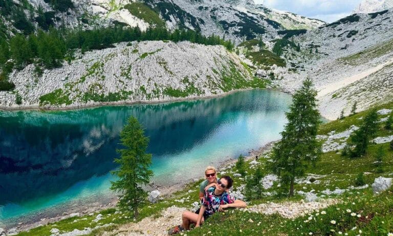 Triglav Lakes Valley: Routes, Difficulty and the Mountain HutTriglav Lakes Valley (Dolina Triglavskih jezer, also called the Valley of the Seven Lakes) is a demanding but…