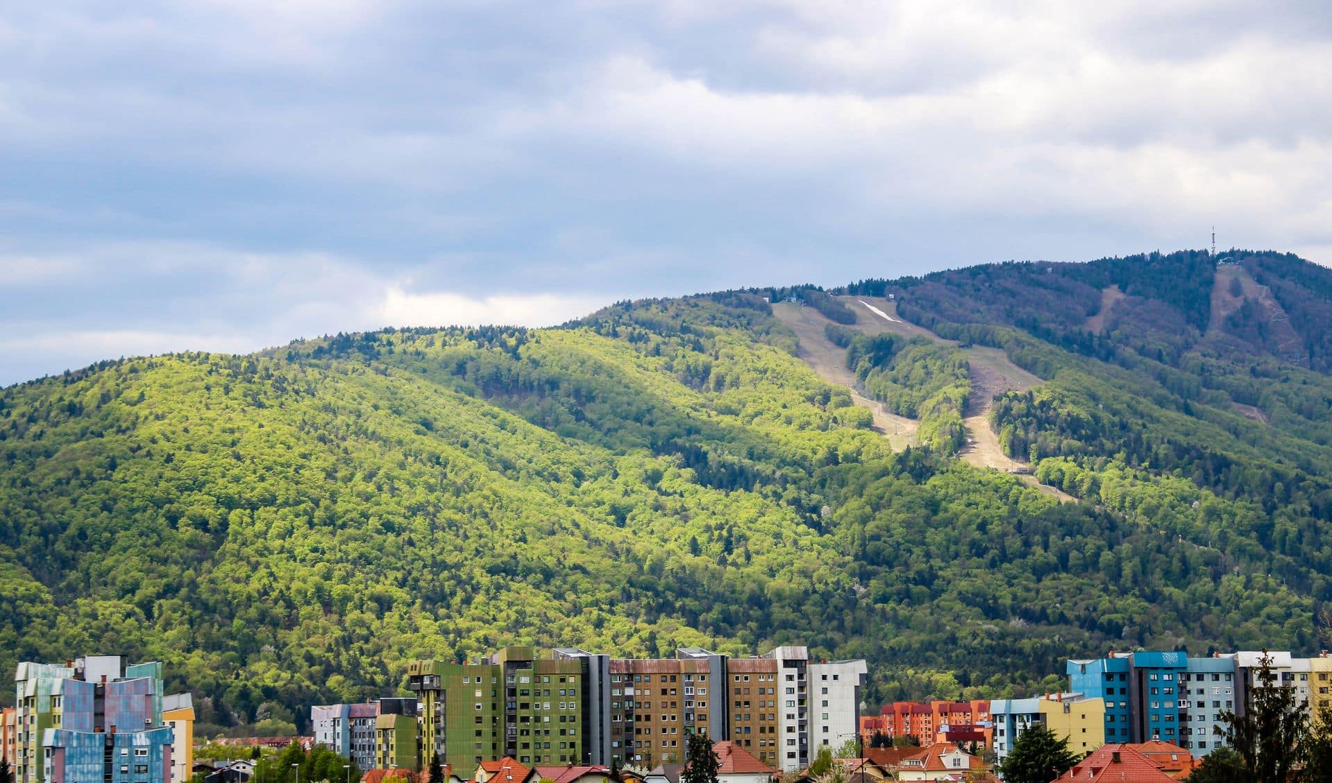
Pohorje is a huge, gently rounded massif of forested hills in north-eastern Slovenia, between Maribor, Dravograd and Slovenske Konjice — the only mountain range in the country built from silicate rock rather than limestone, which is exactly why it looks so different from the jagged Julian or Kamnik-Savinja Alps. There are no real summits to speak of, just broad forested ridges, ski slopes, and a genuinely unusual feature on top: a high-altitude peat bog dotted with small, dark lakes. Almost every route here is graded lahka (easy), and several trailheads — including the highest hut in the range — are reachable directly by car.
Where Triglav is about a demanding two-day alpine ascent and Velika Planina is a high pasture you walk or ride up to, Pohorje is lower, rounder and far gentler than either. You won’t find exposed ridgelines or via ferrata-grade terrain anywhere in the range. What you will find is kilometre after kilometre of easy forest track, a cable car straight out of Maribor, and — right at the top of the plateau — the Lovrenška jezera, a cluster of peat-moor lakes unlike anything else in Slovenia’s mountains.
It sits in the Slovenian Mountains category alongside those two, and it’s the one to point people toward if they want a proper day in the hills without any real physical risk — families, first-timers, or anyone who wants skiing in winter and forest walking in summer from the same base. If you only have one day and don’t want to think too hard about difficulty grades, this is it.
What to Expect on the Trail
Pohorje is a plateau more than a peak, and that shapes everything about hiking here. Most routes start already partway up — either from the Pohorska vzpenjača cable car above Maribor, or by driving straight to Rogla or Ribnica na Pohorju on the southern side — so you spend far less time climbing out of a valley than you would in the Julian or Kamnik-Savinja Alps. The paths themselves are wide forest tracks, old ski-access roads and boardwalks rather than mountain trail in the alpine sense: no scree, no cable-assisted sections, nothing that asks for real scrambling anywhere in the range.
The one place the walking actually feels different is up on the open peat moor around the Lovrenška jezera. The forest stops, the ground turns soft and spongy, and a system of wooden boardwalks guides you between small, dark lakes — anywhere from about a dozen to over twenty of them, depending on recent rainfall — surrounded by marsh tea and round-leaved sundew. It’s flat, easy walking, but you stay on the boardwalks: stepping off them damages a genuinely rare habitat and you can sink further than you’d expect.
Away from the moor, the appeal is really just distance and quiet: long, well-marked forest routes connecting huts, chapels and viewpoints across a plateau that covers roughly 840 square kilometres. Over 70% of Pohorje is forested, so most of the walking is shaded, and sightlines only open up at the ski clearings, the odd rocky outcrop, or the summit of Črni vrh itself.
How Difficulty Is Graded
Slovenia’s official trail-difficulty system, set by Planinska zveza Slovenije (PZS), has three categories: lahka pot (easy path), zahtevna pot (demanding path, usually with some exposure or a fixed cable), and zelo zahtevna pot (very demanding, via ferrata-grade terrain). Slovenian trail-guide sites also use an informal fourth label, delno zahtevna ("partly demanding" — an easy route with one harder stretch), which isn’t an official PZS grade.
Pohorje is, if anything, even gentler than Velika Planina in this respect. Every documented route covered below — to the peat lakes, to the summit of Črni vrh, or out to Areh and Žigartov vrh from the cable car — is rated lahka. There’s no zahtevna or zelo zahtevna route anywhere in the main network, and no informal delno zahtevna label attached to any of these approaches either. That makes Pohorje the most consistently easy destination in this category so far, which is also exactly why it draws families and skiers rather than alpinists.
- Easy — lahka označena pot
Well-graded path, no exposure. This is the grade for every route on Pohorje covered in this guide, from the peat lakes to the summit of Črni vrh.
- Partly demanding — delno zahtevna označena pot (informal)
An easy route with one harder stretch. Not an official PZS grade, and not used for any current route on Pohorje.
- Demanding — zahtevna označena pot
Exposure or a fixed cable. No route on Pohorje is graded this way.
- Very demanding — zelo zahtevna označena pot
Via-ferrata-grade terrain. Doesn’t apply here — for that, see our Climbing Triglav guide.
Choose Your Route
Rogla → Lovrenška jezera (Peat-Bog Lakes)
The shortest, easiest way to the lakes, since Rogla already sits near plateau height. You walk out through meadow and ski-track woodland past Ostruščica before the trees open onto the moor itself and its viewing tower — the main reason most visitors come to this side of Pohorje at all.
Ribniška koča → Črni vrh (highest point)
The easiest realistic way to stand on Pohorje’s highest point. Because Ribniška koča already sits almost at summit height, the actual climb to the treeless top of Črni vrh (1,543 m) is short and gentle, with panoramic views in every direction as reward. Walkers wanting more distance can continue along the longer ridge path atop Ribniško Pohorje (≈6.8 km) instead of the direct out-and-back.
Pohorska vzpenjača → Bolfenk → Areh → Žigartov vrh
The main route on Pohorje’s eastern side, starting with the Maribor cable car itself rather than a drive. The trail passes the Church of St Bolfenk, WWII-era graves, the Church of St Areh and Ruška koča on its way to Žigartov vrh — a genuinely varied walk for very little elevation gain.
Bolfenk — Rozika’s Forest Nature Trail
The gentlest option in this whole category: a short, signed loop through the forest around Bolfenk with stops explaining Pohorje’s plants and wildlife. Good for small children or anyone who just rode the cable car up and wants a short walk rather than a hike.
A longer valley approach to the peat lakes also exists, climbing from the village of Lovrenc na Pohorju itself (around 8.5 km one-way, with considerably more elevation gain than the Rogla route) for those who’d rather walk the whole way up than drive partway. Pohorje’s actual trail network is far larger than four cards can cover — long-distance routes like the Kotnik Trail and the Pohorje-Kozjak Trail connect the range to neighbouring Kozjak — so check hribi.net for the fuller table if you want to see every option.
Getting to the Trailhead
The main way onto the eastern side of the range is the Pohorska vzpenjača, the cable car running from Zgornje Radvanje on the edge of Maribor up to Bolfenk. As of the price list effective 1 June 2026, a one-way adult ticket is €10 and a return is €16 (€7 / €11 reduced for children, students, seniors and people with disabilities); a family return for two adults and up to two children costs €30, with €9 for each extra family member, and groups of 20 or more get a discounted €10 return per person. There’s no toll road involved — it’s simply a cable car ticket.
Rogla and Ribnica na Pohorju, on the southern side, are reached by ordinary mountain road rather than any toll route, with on-site parking at both resorts. Public transport beyond the city of Maribor itself is limited: Maribor’s urban bus network reaches toward the lower cable car station, but there’s no reliable direct service to Rogla or Ribnica na Pohorju, so a car is the practical way to reach either trailhead if you’re not starting from the cable car.
What to Bring
- Sturdy trail shoes — mostly forest track and boardwalk, nothing technical, but it can be genuinely muddy away from the marked paths.
- Insect repellent — the dense forest and the peat moor itself attract mosquitoes and ticks, especially from late spring through summer.
- Water — there’s little reliable water along most of these routes once you’re away from the huts.
- A light rain layer — Pohorje’s forested western-facing slopes catch more rain than the drier limestone ranges further west in Slovenia.
- Cash — for the cable car ticket desk and the smaller mountain huts, which don’t all take cards.
- An offline map or the hribi.net app — Pohorje’s forest roads and ski tracks crisscross confusingly, and it’s easy to end up on the wrong one.
When to Go
Pohorje is one of the few Slovenian mountain destinations that’s genuinely walkable year-round, thanks to its low elevation and gentle grading. Late spring and early summer typically bring the fullest peat lakes, since the moor’s water level depends on recent rainfall and can leave noticeably fewer lakes visible after a dry stretch later in the season. Summer is when every hut and the cable car itself are reliably open, though afternoon thunderstorms build over the plateau the same as anywhere else in Slovenia, so an early start is worth it. Autumn brings the forest colour the range is genuinely known for, and winter turns Rogla, Mariborsko Pohorje and the Kope-Ribnica area into working ski resorts, with the cable car and a handful of huts — including Ribniška koča and Ruška koča — staying open through the cold months even as the forest trails themselves get harder underfoot.
Safety on the Trail
The real risk on Pohorje is getting disoriented, not technical terrain. The plateau’s forest roads and old ski tracks cross each other constantly and many look alike, so carry a map or app rather than relying on memory, especially on the longer eastern-side routes. Around the Lovrenška jezera, stay strictly on the boardwalks: the peat moor can be deeper and softer than it looks off the marked path, and it’s a protected habitat. Ticks are genuinely common in Pohorje’s dense forest undergrowth from spring through autumn, so check yourself after a walk. Afternoon thunderstorms build over the plateau in summer the same as anywhere else in Slovenia, and forest access roads can ice over in winter even when the main cable car is still running. In an emergency, call 112, or contact Gorska reševalna zveza Slovenije (Mountain Rescue Association of Slovenia) directly.
The Hut
Ribniška koča
Ribniška koča sits on a small plateau below Mali Črni vrh, with a small ski resort of three surface lifts right beside it. The original lodge, built by Maribor merchant Josip Hutter, was burned down during the Second World War and rebuilt by hiking enthusiasts in 1949. Being drivable rather than walk-in-only makes it an easy base for both the peat-lake routes and the Črni vrh summit walk.
On the eastern side of the range, Ruška koča (Ruše Lodge) plays a similar year-round role at 1,246 m near Areh, with a history going back to a hut built by locals in 1907 and rebuilt in 1946 after wartime destruction. Neither hut is the kind of high-alpine refuge you’d find on Triglav — they’re closer to year-round mountain inns, reachable by ordinary roads, which fits the whole character of this range.
Day Hike or Overnight?
The default for almost everyone, and genuinely the right call. Since both main trailheads are drivable or cable-car accessible and every route here is short and easy, you can realistically combine the peat lakes, a hut stop and a summit walk into a single day without rushing.
Worth considering mainly if you’re combining hiking with skiing, or want the plateau to yourself at sunrise. Book Ribniška koča or Ruška koča ahead, especially on winter weekends when the ski resorts are busy — neither publishes guaranteed dorm capacity, so confirm directly rather than assuming a bed will be free.
Frequently Asked Questions
Is Pohorje a good hike for beginners and families?
Yes — it’s the easiest range in this category. Every documented route is graded lahka (easy) by PZS, with no exposed sections or technical terrain anywhere, and several trailheads are reachable directly by car or cable car rather than requiring a long walk-in first.
What is the highest point of Pohorje?
Črni vrh (Black Peak), at 1,543 m. It’s a treeless, forested-approach summit with panoramic views, reached most easily via a short, gentle walk from Ribniška koča.
How do I get to the peat-bog lakes on Pohorje?
The Lovrenška jezera are most easily reached from Rogla, about 1 h 20 min one-way via ski tracks and wooden boardwalks, with longer alternative approaches from Ribniška koča, Pesek hut, or the valley village of Lovrenc na Pohorju itself.
Can I drive up to Pohorje, or do I have to hike in?
Unlike most Slovenian mountains, you can drive directly to several trailheads, including Rogla and Ribniška koča — the highest hut in the range. The eastern side is instead reached by the Pohorska vzpenjača cable car from Maribor.
Is Pohorje good for skiing as well as hiking?
Yes. Rogla, Mariborsko Pohorje and the Kope-Ribnica area all run as ski resorts in winter, and several huts, including Ribniška koča and Ruška koča, stay open through the season — one of the few places in this category where the same base works for both activities.
More to read
Fresh from Slovenia Travel Tips
Thermal Spas in Slovenia: The Best Terme for a Winter Visit
Quick answer: Slovenia’s thermal spas (terme) stay open all winter, but what’s actually usable varies a lot by…
Slovenia Travel in December: Weather, Crowds, Hiking and What to Expect
December is when Slovenia goes fully festive and genuinely cold — lift-served skiing begins at the lower resorts,…
Christmas Markets in Slovenia Beyond Ljubljana: Ptuj, Kranj, Bled, Maribor and Celje
Quick answer: Ljubljana isn’t the only Slovenian city with a festive December program. Ptuj, Kranj, Bled, Maribor and…
Part of our Slovenian Mountains guide. If you want an easy plateau walk with a completely different atmosphere, see our Velika Planina guide, or for an actual demanding summit day, see Climbing Triglav.

Related guides
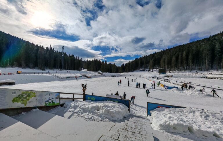 Pokljuka: Hiking, Biathlon and Cross-Country Skiing on Slovenia’s High PlateauPokljuka is a forested karst plateau in the Julian Alps, about 15 km west of Bled and part…
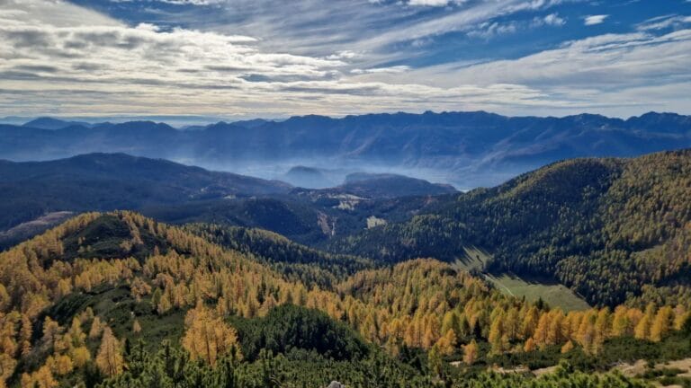 Viševnik: Routes, Difficulty and Slovenia’s Easiest Two-ThousanderViševnik (2,050 m) is routinely named the most-visited peak above 2,000 m in Slovenia — not because it’s…
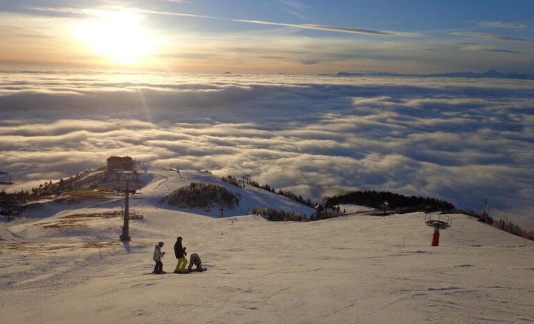 Skiing in Slovenia: Resorts, Piste Lengths and 2026/27 Opening DatesSlovenia’s ski season normally runs from late November to late March, spread across eleven resorts from the high…